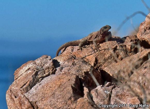
Spiny Chuckwalla (Sauromalus hispidus)
Created: February 3rd, 2011 - 12:11 AM
Last Modified: February 5th, 2011 - 11:50 PM Entered by: Gary Nafis
Record 62396
Last Modified: February 5th, 2011 - 11:50 PM Entered by: Gary Nafis
Record 62396
|
Country: Mexico |
State: Baja California (norte) |
County: Ensenada |
Time: 2002-06-20 07:30:00 |
|
|
Qty: 1 |
Age: Adult |
Sex: -- |
Method: Visual encounter |
Habitat: Rocky Desert Island |
|
Body Temperature: ----- |
Air Temperature: ----- |
Ground Temperature: ----- |
Humidity: ----- |
|
|
Sky Conditions: Clear |
Moon Phase: ----- |
Elevation: 20.00ft |
Barometric Pressure: ----- |
|
Vouchers

Comments
Don added in a georeference program so the database can check if any of your counties/municipalities is mismatched with your GPS coordinates. Of course, it only works if you have GPS coordinates in the record. Just go to this link - if nothing shows up, then you have no GPS/municipality errors:
http://www.naherp.com/search.php?error=1265
Thanks. Municipalities, not counties - that's the key. I'd still like to see a map of the cape showing the border of the municipalities, but I think I've got it right.
http://en.wikipedia.org/wiki/Municipalities_of_Baja_California
http://en.wikipedia.org/wiki/Municipalities_of_Baja_California_Sur
Maybe that will help
None of my Baja maps show counties, and I can't find any county maps online...
Need counties on these, mega awesome entries..